
Countries around the world face higher risks of extreme weather events like floods, droughts and extreme heat as the ongoing El Niño intensifies and extends, with the World Meteorological Organization (WMO) now assessing it will become the strongest in history.
In its latest update, WMO assessed with 100% certainty that El Niño — the result of warming ocean temperatures in the central and eastern tropical Pacific that affect weather extremes globally – will persist through February 2027, instead of the earlier projection of November 2026.
“El Niño is being supersized before our eyes. The science leaves no room for doubt: the planet is in uncharted waters, and those waters are heating up,” said United Nations Secretary General António Guterres. “Sea surface temperatures are rising, temperatures keep climbing, and the world is in the danger zone of extreme weather.”
This is also the first time that a WMO El Niño and La Niña update has been so unequivocal, reflecting the strong agreement within WMO’s extensive network.
WMO’s update comes on the heels of devastating floods in Nepal that killed over 1,000 people. While El Niño is not linked to climate change, combined with the extreme weather events that climate change is already bringing, El Niño stands to compound the damage.
“The race now is between rising risks and our commitment to take climate action and protect people,” Guterres said. “We must win that race.”
Also read: Nepal’s Flood: Chilling Example of Climate Devastation Facing Developing Countries
2026 could surpass 2024 as the hottest year on record
While both El Niño and La Niña occur naturally, the intensity of these phenomena can bring staggering devastation.
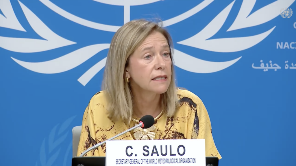
“El Niño in Spanish means boy child – but it has the potential to deliver a massive blow to communities and economies across the world. We are already seeing disruption and devastation from droughts and floods, and we expect these impacts to increase as El Niño intensifies,” said WMO Secretary-General Celeste Saulo.
She explained that the El Niño in the year 2023-24 resulted in 2024 being the hottest on record. The current El Niño could do something similar for the year 2026, Saulo said.
“This exceptional El Niño demands exceptional preparation and response. Never before in the 50-year history of the World Meteorological Organization have we launched such a major mobilization with National Meteorological and Hydrological Services who are on the frontline of delivering the forecasts and services to save lives and livelihoods,” Saulo said.
Exceptional ocean heat in the tropical Pacific

Sea surface temperatures across the central-eastern equatorial Pacific, the region at the heart of El Niño, are already well above average – one of the tell-tale signs of El Niño – and are continuing to rise.
The widely used Niño 3.4 index, which measures sea surface temperature anomalies in the central-eastern equatorial Pacific, has strengthened markedly from an average of +1.5 °C above normal during May-July 2026 and +2.0 °C above normal in July.
Weekly values subsequently increased further between late July and mid-August, ranging from approximately +2.2 °C to +2.6 °C above average, indicating continued intensification.
Even more exceptional warmth is present below the ocean surface. In some areas, subsurface ocean temperatures were more than 8°C above average during July and early August.
Altogether, the surface and subsurface ocean conditions provide strong support for continued El Niño conditions and the potential for further strengthening during the coming months, the Update says.
Different impacts in different places
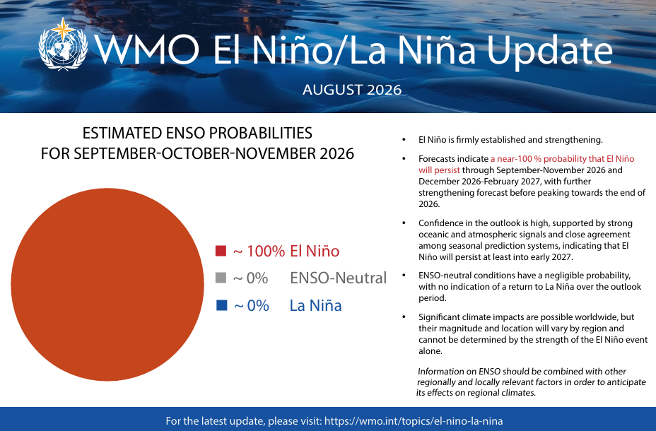
A very strong El Niño event increases the likelihood of major changes in rainfall, temperatures and atmospheric circulation across many regions of the world.
However, the strength of an El Niño event alone does not determine how severe its impacts will be in any individual country or region. Its effects vary according to location and season and can be modified by other climate drivers, including conditions in the Indian and Atlantic Oceans.
WMO said while extreme weather events are a certainty, it doesn’t have to mean destruction if countries prepare in advance and invest in early warning systems.
“WMO is committed to working closely with partners across the United Nations and humanitarian system to provide the climate intelligence and insights needed to support disaster management and climate-sensitive sectors like agriculture, health, energy and water resources,” Saulo said. “We have no time to lose.”
Combat the infodemic in health information and support health policy reporting from the global South. Our growing network of journalists in Africa, Asia, Geneva and New York connect the dots between regional realities and the big global debates, with evidence-based, open access news and analysis. To make a personal or organisational contribution click the donate button below.